 |
| CLICK ON THE MAP TO ENLARGE |
At the beginning of their journey to the North, the Governor and Mrs. Macquarie, and Captain Antill rode on horseback, while Lieutenant Maclaine, Lieutenant Campbell and Mr. Meehan accompanied the party on foot.
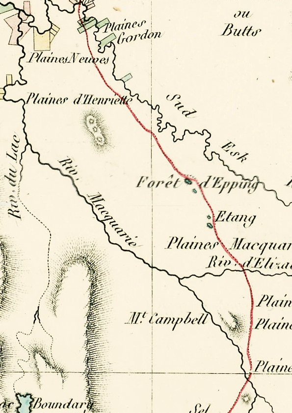
Excerpts from Macquarie's journals tell us about the names he gave places along the route on this expedition – Macquarie Springs, York Plains, Antill Ponds, Mount Henrietta, Macquarie River, Elizabeth River, Macquarie Plains, Epping Forest.
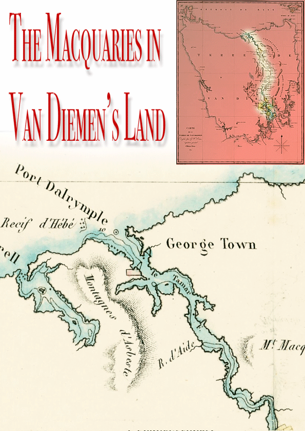
The party crossed the South Esk River, where the water was deep enough to reach the axles of the carts. Fresh draught bullocks had been sent from Major Gordon at Port Dalrymple.
Corri-Lyn Cascade, one half mile east of Paterson's Island on the North Esk, was named, and the journey made through farms to the village of Launceston.
Bonfires were lit, and the people frequently cheered during the evening to welcome the Governor. During the next week Macquarie set out to inspect the country between Launceston and the South Esk to select some country for the settlers from Norfolk Island. He changed the name of Brumby's Plains to Breadalbane Plains, and rode along the right bank of the South Esk and named Norfolk Plains (Longford), which commenced from about half a mile below where the Macquarie River flows into the South Esk. He decided upon these plains as suitable for farms for the Norfolk Island settlers, stating that a good cart road might be made to Launceston not exceeding nine miles.
SOURCE: Convicts & Carriageways 1988
 |
| PLEASE CLICK ON A MAP TO ENLARGE |